GAZA: Newly updated satellite imagery available through Google Maps has drawn attention to the extensive destruction visible across the Gaza Strip following the prolonged Israeli military campaign in the besieged Palestinian territory.
The satellite images show large areas where buildings and residential structures have been destroyed or severely damaged, with entire neighborhoods appearing drastically altered compared with earlier imagery.
The updated view provides a stark visual indication of the scale of devastation across Gaza, where extensive damage has been reported to homes, public infrastructure and other civilian facilities.
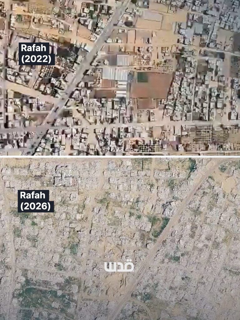
However, the satellite imagery captures only part of the destruction. Many areas of Gaza remain difficult to assess from satellite views, meaning the images do not necessarily reflect the full extent of the damage on the ground.
The devastation visible in the imagery comes amid the continuing humanitarian crisis in Gaza, where the destruction of residential areas and critical infrastructure has displaced large numbers of Palestinians and severely affected access to essential services.